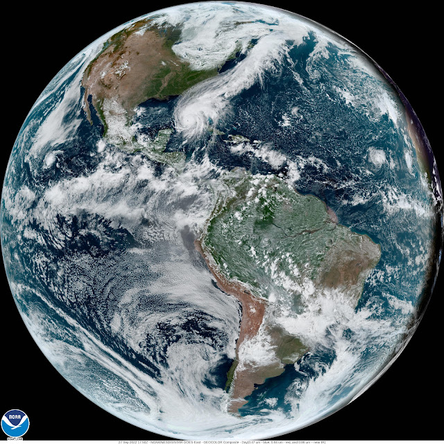
Hurricane Ian: Full Disc View | NOAA GOES-EAST Weather Satellite
Sept. 27, 2022 Update: Major Hurricane Ian is centered over the southeastern Gulf of Mexico near 23.5N 83.3W at 27/1800 UTC, or 75 nm SSW of the Dry Tortugas, FL, moving N at 9 kt. Minimum central pressure is 955 mb. Maximum sustained wind speed is 105 kt with gusts to 125 kt.
San Juan y Martinez, Cuba recorded a peak wind gust of 112 kt when Ian passed over Cuba earlier this morning. The same station measured 7.95 inches of rain during the 24 hr period ending at 27/1200 UTC. The city of Pinar del Rio experienced the calm eye of Hurricane Ian. The calm lasted for 1 hr 30 min. Tropical storm force winds extend outward 120 nm from the center.
Seas of 12 ft or greater are occurring over the far NW Caribbean, western Straits of Florida and southeastern Gulf of Mexico, in the area from 20.5N to 25N between 81W and 86W. Peak seas are reaching 25 ft.
Credit: National Oceanic and Atmospheric Administration (NOAA)
Release Date: Sept. 27, 2022
#NASA #NOAA #Space #Science #Satellite #Earth #Planet #Atmosphere #Hurricane #HurricaneIan #GOESEast #GOES16 #CIRA #Geocolor #Cuba #GulfOfMexico #Florida #UnitedStates #CaribbeanSea #Atlantic #AtlanticOcean #Weather #Storm #Meteorology #STEM #Education

No comments:
Post a Comment