Our Earth: February 2, 2022 | NOAA/NASA DSCOVR
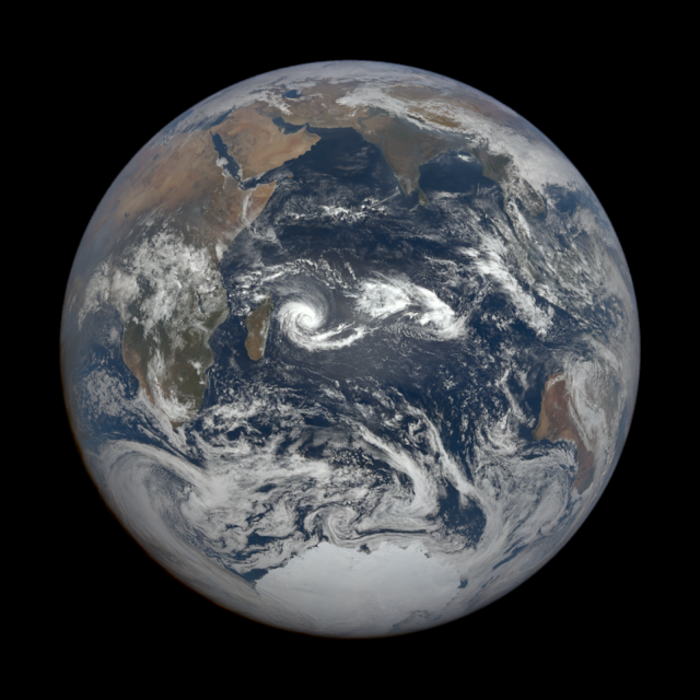
This color image of Earth was taken on February 2, 2022, by the Earth Polychromatic Imaging Camera (EPIC), a four megapixel CCD camera and telescope from one million miles away—beyond the Moon's orbit. Tropical Cyclone Batsirai can be seen in the Indian Ocean close to the island country of Madagascar located approximately 400 kilometers (250 miles) off the coast of East Africa across the Mozambique Channel.
The Deep Space Climate Observatory is a National Oceanic and Atmospheric Administration (NOAA) space weather, space climate, and Earth observation satellite at the Sun-Earth L1 Lagrange point. It was launched by SpaceX on a Falcon 9 v1.1 launch vehicle on February 11, 2015, from Cape Canaveral. This is NOAA's first operational deep space satellite and became its primary system of warning Earth in the event of solar magnetic storms.
(Source: Wikipedia)
Image Credit: NASA/National Oceanic and Atmospheric Administration (NOAA)
Image Date: February 2, 2022
#NASA #NOAA #Earth #Space #Satellite #Planet #Weather #Clouds #TropicalCyclone #Batsirai #IndianOcean #Madagascar #Africa #MiddleEast #India #Bhārat #Gaṇarājya #Australia #Antarctica #EarthObservation #DeepSpace #RemoteSensing #EarthFromSpace #Climate #DSCOVR #EPIC #STEM #Education
No comments:
Post a Comment